

 Click to embiggen
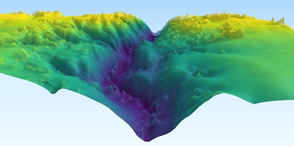
This is the earth under a stream inside a forest in Iowa, with all the trees and the water digitally removed. Or rather, with just the earth showing – thanks to the radar-like laser technology called lidar (for “LIght Detection And Ranging”).
Lidar is really good at showing what’s underneath all the stuff you can see on a normal camera or with your eyes. It’s been used by archaeologists to find lost cities, and by geologists like the U.S. Geological Survey folks who made this image. As they explain:
The vegetation makes optical identification of the presence of water in channels difficult. The digital models are being used to measure the structure of vegetation adjacent to channels in an attempt to identify features that indicate the presence of surface water.