
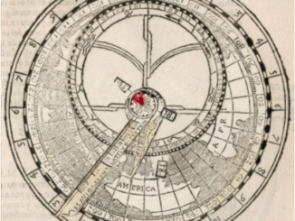
Science Art: Instrumento de Geographia y Cosmographia, 1606
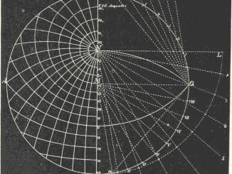
This is a tool from Theatro del Mvndo y de el Tiempo, a book of star maps by Giovanni Paolo Gallucci, Miguel Perez, and Sebastian […]
This is a tool from Theatro del Mvndo y de el Tiempo, a book of star maps by Giovanni Paolo Gallucci, Miguel Perez, and Sebastian […]
A photo from the NASA PACE Ocean Sciences gallery. The Plankton, Aerosol, Cloud, ocean Ecosystem mission is a satellite observatory created by Goddard Space Flight […]
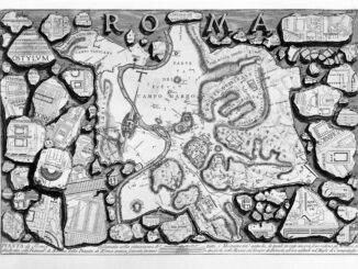
It’s a map. An old map of an even older city. This is Piranesi’s map of ancient Rome (“and Forma Urbis”) from Le Antichità Romane, […]
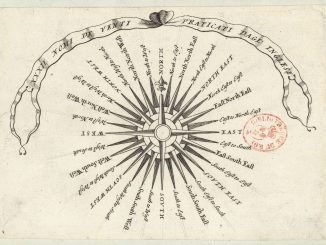
This is one of four compass roses created by Vincenzo Coronelli, a 17th-century cartographer. I found them all on Wikimedia Commons, which got them from […]

SONG: “Good People Grow”. ARTIST: grant. SOURCE: Science 29 Sep 2022, “This lagoon is effectively a person, says Spanish law that’s attempting to save it,” […]
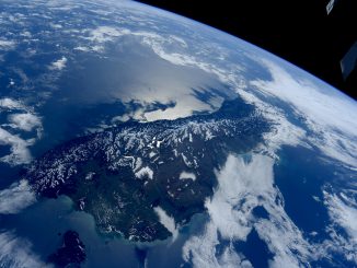
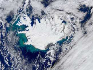
Here’s a picture of a distinctive bit of geography. There are hobbits down there, and members of Split Enz and The Chills, and some of […]
Click to embiggen As described on Wikimedia Commons (who got this diagram from the British Library), the image was “taken from page 100 of ‘Grundzüge […]

Click to embiggen From the USGS: This image is a cropped rendition of two aerial images that demonstrate satellite-derived cyanobacteria concentrations in surface waters from […]

Click to embiggen The Age of Exploration included at least a little bit of schoolwork. Here are navigation students learning the ways of current and […]
SONG: “Facing North”. ARTIST: grant. SOURCE: Science News, 18 Mar 2019, “People can sense Earth’s magnetic field, brain waves suggest,” as used in the post […]
This story has been doing the rounds lately, but the research is available via Science Direct (publishing the Quaternary Science Reviews article). A team of […]
Click to embiggen Polar bears salute the midnight sun as Arctic explorers sail to the horizon. This image is part of a page of “Cosmic […]
Click to embiggen The answer, from the US Geological Survey’s Facebook page, is an algal bloom in Lake Erie, as photographed by Landsat: In late […]
Click to embiggen vastly The USGS Earth Explorer program shared these before-and-after pictures of Puerto Rico. The main difference that’s visible from the Landsat 8 […]
Click to embiggen An illustration illustrating illustration. This is how standardized maps are made. These are the standards. From The preparation of illustrations for reports […]
Copyright © 2026 | WordPress Theme by MH Themes